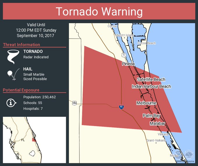
Brevard County is under yet another tornado warning as Hurricane Irma starts impacting Florida, according to the National Weather Service in Melbourne.
The weather service expanded the range of the latest warning into include much of central and southern Brevard, including Melbourne, Palm Bay and beachside cities and towns.
More than 250,000 county residents fall under the new warning, which will remain in effect until 12 p.m.
Update, 11:05 a.m.:
Another tornado warning has been issued, this time for southern Brevard County, until 11:30 a.m.
The affected area is just south of Melbourne.
Original story:
A tornado warning covering Palm Bay and West Melbourne was cancelled early after the storm band that prompted the warning grew weak, National Weather Service officials reported. It was the second tornado warning issued for the south Brevard County area.
Residents were urged to take cover before weather officials cancelled the warning. "The storm which prompted the warning has weakened below severe limits, and no longer appears capable of producing a tornado. Therefore the warning will be allowed to expire. However heavy rain and strong winds will continue as Hurricane Irma lifts north from the Florida Keys," the weather service reported.
The warning was originally set to expire at 9:45 a.m.
"It was radar indicated," said Peggy Glitto, a meteorologist with the National Weather Service in Melbourne, of the storm formation that set off the warning. "We should begin seeing some of the heavy bands (from Hurricane Irma) coming up."
A tornado warning means that conditions indicate a tornado or funnel cloud may be in the affected area. Brevard County remains under a tornado watch until 12 p.m.
The weather service also reports wind gusts of up to 45 mph. Tropical storm winds are expected to arrive in Brevard sometime around 2 p.m. and then spread toward the north end.

